Aerial UAV—Control Survey

Aerial UAV—Control Survey


Negotiable Min Order Quantity Unit

Required Quantity
Place of Origin
China
Brand name
TTF
Payment Terms
Negotiable
Production method
Negotiable
Shipping / Lead Time
Negotiable / Negotiable
Keyword
fpv drone, racing drone
Category
Other Consumer Electronics

Shenzhen TitanFlying Technology Co., Ltd

Membership
BIZ
Country / Year Established
China China / 2015
Business type
Trading Company
Verified Certificate

6

Product name Aerial UAV—Control Survey Certification -
Category Other Consumer Electronics Ingredients -
Keyword fpv drone , racing drone Unit Size -
Brand name TTF Unit Weigh -
origin China Stock -
Supply type - HS code -

Product Information


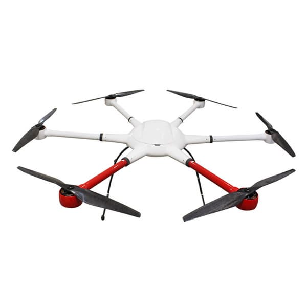
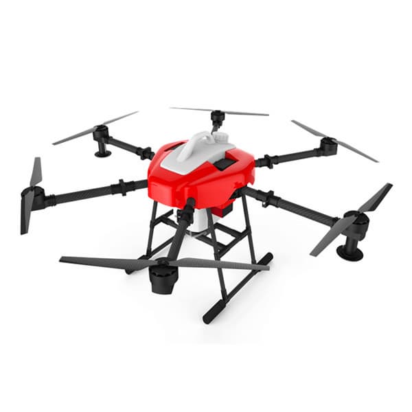
The Aerial UAV is to ensure the accuracy of aerial triangulation and determine the absolute position of objects in space. In the conventional low altitude digital aerial photogrammetry external specification, the layout of control points is specified in detail, which is the basis for ensuring the accuracy of large scale mapping. The technique of oblique photograph requires higher image overlap than traditional photography, and the requirement of image control point layout is not suitable for high resolution unmanned aerial UAV oblique photogrammetry. Aerial UAV usually adopts GPS positioning mode, and has POS data itself. It plays a significant role in determining the relative position between images, and can improve the accuracy of empty three computation.

1 Conventional three-dimensional modeling

Based on the Smart 3D algorithm, a control interval can be provided from the angle of the final aerial triangulation feature point-cloud. The proposed value is to set a control point at every 20000~40000 pixels, in which the difference POS data (relatively accurate initial value) can be relaxed to 40000 pixels, and at least 20000 pixels of the differential POS data are set. At the same time, it should be applied flexibly according to the actual terrain and terrain conditions of each task, such as very large terrain undulating, large area vegetation and surface water features very few, and need to increase the control point. The measurement of control points adopts attached traverse measurement to get high-precision location information.

2 Safeguard of emergency surveying and mapping

After the earthquake, landslides, debris flow and other natural disasters, in order to obtain the disaster area’s three-dimensional data, we can not control the measurement according to the traditional operation mode. By reading the coordinates of the Google map, the handed GPS measurement, and the RTK measurement, the few control points of the disaster area can be quickly obtained, and the real three-dimensional model of the disaster area can be generated to provide assistance for post-disaster relief.

3 The selection requirements of point location

The target image of the image control point should be clear, and select the place where the spot is easy to be identified, is fixed and easy to measure.When the condition is available, we can make the mark point of the control point of the field work first, usually choose the white (or red) paint to mark the cross sign, and test several images before the aerial photography to ensure that the cross sign can be correctly identified on the oblique image. After the control point measurement is completed, it is necessary to make the control point distribution map in time, control the spot information table, accurately describe the location and position information of each control point, and facilitate the use of the internal pricking points.

B2B Trade

Price (FOB) Negotiable transportation -
MOQ Negotiable Leadtime Negotiable
Payment Options Negotiable Shipping time Negotiable

Shenzhen TitanFlying Technology Co., Ltd

Country / Year Established
China China / 2015
Membership
BIZ
Business type
Trading Company

6

President
Hisen
Address
NO.15 Chaoyang road, Yanluo street, Songgang town, Baoan District, Shenzhen
Product Category
Electrical Equipment,Other Consumer Electronics
Year Established
2015
No. of Total Employees
501-1000
Company introduction


Established in 2005, Shenzhen TitanFlying Technology Co., Ltd (TTF) is located in Shenzhen Univercity Town, known as the silicon vally of China. 
   TTF Technology is a high-tech enterprise and professional Aero-Model manufaturer that unifies product design, research&development, production, marketing and customer service. Our main product is the UAV Power System, Gimbal System and PTZ Control System.  
   We have a whole machining industry chain. All our products, from the materials processing to completed products, were manufacturered by ourselves. Thus the quality and the consistency can be well controlled and always be the top of the industry. Besides the standard edition, we also supply customer-exclusive edition, which has its own SN for each product. (Support all your requests)
   ""Touch The Future"" is the company slogon of TTF Technology, and we know that we cannot achieve this goal without your support and attention. So we will continuously provide you our best-quality products with super material and unique technology.
Main Markets

Belarus Belarus

Botswana Botswana

Burkina Faso Burkina Faso

Cape Verde Cape Verde

Croatia Croatia

Egypt Egypt

Iran Iran

Kuwait Kuwait

Main Product

Related Products

Other buyers also search

Membership Grade

BUYER

Biz Pro VIP

SELLER

Biz Pro VIP
팝업닫기
Live Chat A new message arrives
from a business partner.

No Data

  • There is no data to load
  • Check out the My TK > My Inquiries list.
  • After agreeing to the use of the Live Chat service, the list is printed only when there is at least one history of receiving or sending a Live Chat request.

If you have not yet agreed to use the Live Chat service,

You can use the Live Chat freely after agreeing to the use of the Live Chat service.

View more
View more